Arenal: The Hidden Volcano Breaks the Streak
- on 01.13.09
- Costa Rica
- 1 Comment
- Digg
- Del.icio.us
Monday, January 5, 2009
The winds that had been howling all night long were still howling when we rose in the morning. They had been joined by a light rain. Our plan for the day had been to do yoga overlooking the lake and then ride to have lunch at the famous restaurant with a view of the lava flows on Arenal. It was time for plan B.
We had the Typical American Breakfast cooked up by our typical American boy chef. By the time the bikes were loaded and we were ready to go, the rain has slackened to a drizzle. I really can’t complain about the weather – we had had an amazing streak of good weather luck going. We had not had a rainy day since Northern California, nearly 2 months of riding in sunshine. The Miraflores cloud forest rain didn’t count to me because we deliberately rode from a partly cloudy day into a cloud forest, where it’s supposed to rain. Today was the first day of unavoidable rain and the rain liners felt awkward and uncomfortable.
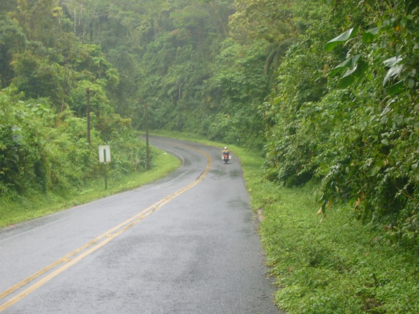
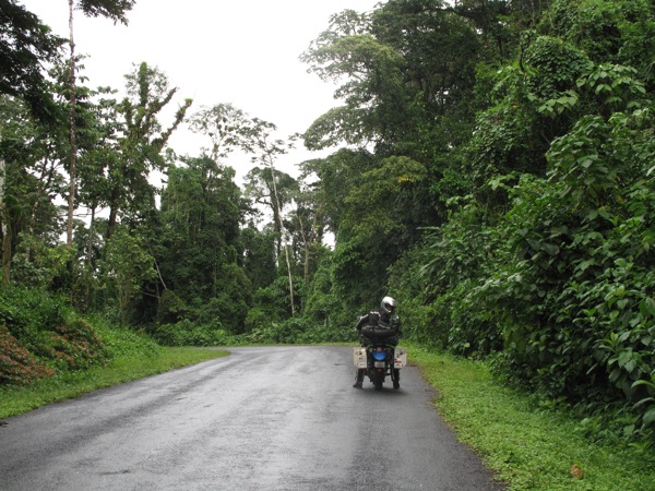
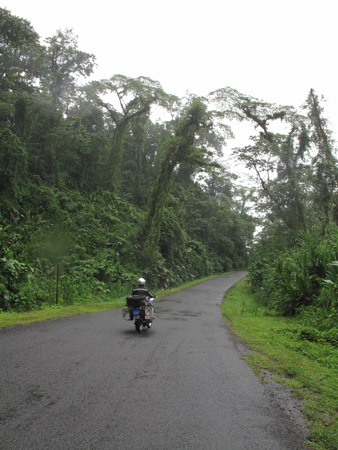
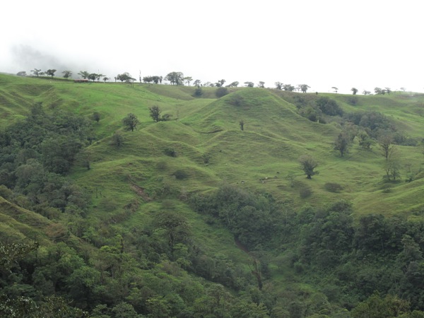
We rode clockwise from the south end of Lake Arenal around the top and east towards the base of the volcano, although not even the base was visible through the clouds. I just knew it was in that general direction of the low gray wall of mist. Once past the cleverly named town of Arenal, across Lake Arenal from the volcano Arenal, the road narrowed and the vegetation thickened. I was actually enjoying the ride at this point. Many forests we had been in prior were technically called jungles, but this was the first time it actually felt like a jungle.
Deep, deep green plants, trees, and mosses towered over the road from both sides. Mosses grew on plants that were growing on other plants that were growing out of tree branches whose trunks were obscured from view by the giant leaves of the ground plants. Leaves with the familiar shape of an oak leave were as big as your torso. Proper jungle.
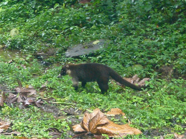
At some point, we came across people parked on the side of the road, feeding a pozole. I’d never seen one before. The occupants of the car didn’t believe in the theory of not feeding wild animals as they were feeding the creature everything they could find in their car. Apparently pozoles love cheetohs as it was worked into a frenzy of epicurean joy chasing after each one. Its fur was soon covered in orange flecks of cheetohs dust.
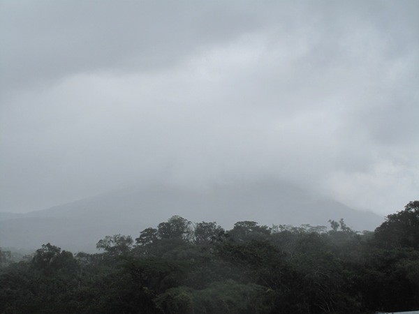
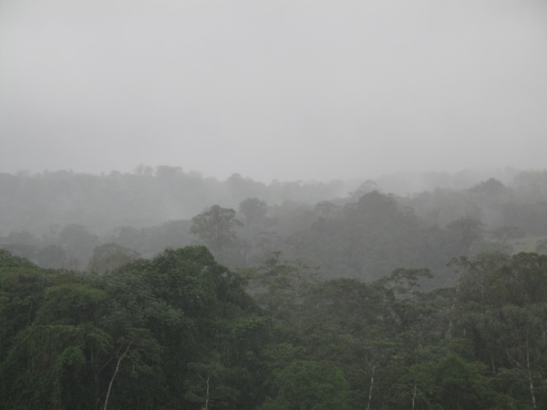
We rode across the dam and past the base of the volcano, which was actually visible from the back side (the base, not the volcano). I was even able to see the very bottom edge of an old lava flow on one slope. The only time I was able to see what the volcano looked like was on a billboard we drove by. The rain was steady by now, but we were both dry except for our hands. We had both chosen to stick with the summer gloves as the waterproof winter gloves were just too hot and we kept hoping the rain would end. Wet hands aren’t so bad if you turn the heated grips on.
We continued our ride east, towards another town at the base of another Volcano, Cuidad Quesada. The actual name of the city is San Carlos, but is referred to on the maps and road signs as the Burnt City. It was a decent sized town. We rode past a Suzuki and then a Yamaha dealer, so we stopped at the latter and I went in to look for a spare quart of oil. They had nothing suitable so I walked down to Suzuki who only carried synthetic oil. Annoying but not dire yet.
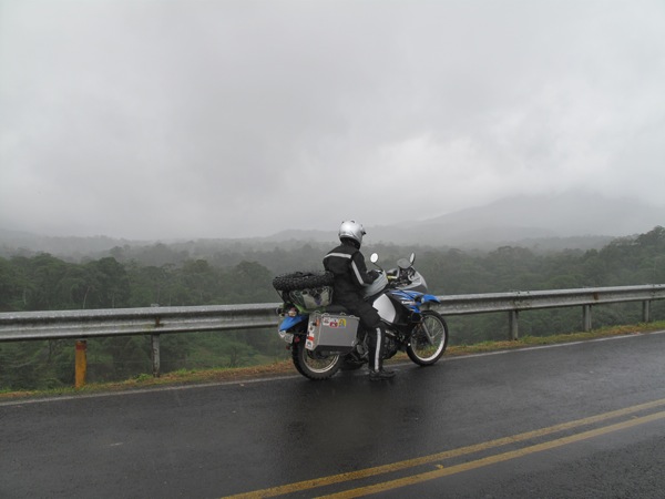
While we were remounting to head out, I asked one of the employees for road directions and his opinion of the road further east. He said the road was terrible and very dangerous. I hadn’t figured out yet how pointless it was to ask locals for directions as they have rarely, if ever, have left their home town. With that seed of doubt planted in my mind and the fact that it was already 2pm, we passed on the more interesting road to the east and headed south through Alajuela to rejoin the main highway. The local had told me we’d be crossing a 3000m pass so I was looking forward to the views.
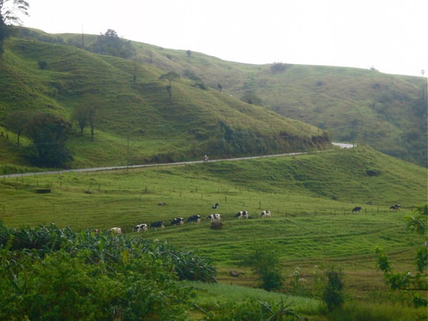
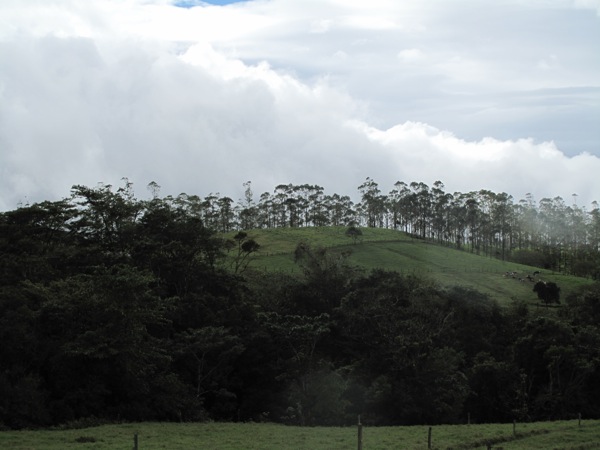
The climb up from the town wound through incredibly bright green hillside farms. The low clouds wrapped around the rounded hilltops as we zoomed upwards. I wasn’t used to the map scale for these small countries and was shocked to see that the city 2/3 of the way through this mountain route was only 29km away. The Mexico maps really affected my sense of scale when reading a map dedicated entirely to Costa Rica.
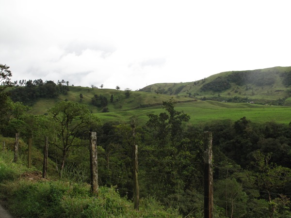
The ride through hills was pleasant, but the local was incorrect about the altitude. The peak pass was only 2000m and we were soon winding our way down to the central valley. We rejoined the Pan American highway and were soon dumped into downtown San Jose. The bypass street signs are never clear. We stopped for a late lunch and then continued through the city, again missing the sign to the main highway. We rode slowly further in the dark until we reached our stopping point for the night, Cartago.
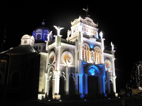
Cartago (Carthage) had been the capital for 300 years, but it was a rather charmless commercial town. Our hotel was across the street from the cathedral, which provided the only beauty the town had to offer. It was colorfully lit at night and looked like a Disney castle. We slept poorly that night, waking up several times to check on the bikes which were highly visible from the street locked behind a chain link fence.
Leave a Reply
You must be logged in to post a comment.