El Rosario to Santa Rosalia: Desert Revelations
- on 11.22.08
- Baja
- 6 Comments
- Digg
- Del.icio.us
Friday, November 21
Today was one of those days I dreamed about before we started this trip. It was a day of near perfect motorcycling, riding through the central deserts of Baja, surrounded by an infinite expanse of cactus.
We knew we were planning on putting in some miles today, so we got up extra early. We had breakfast at Mama Espinoza’s and managed to be on the road by 8:30. Somehow we just can’t get our morning preparations to take less than two hours.
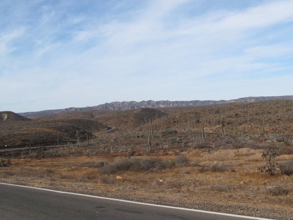
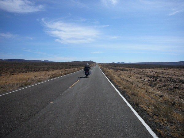
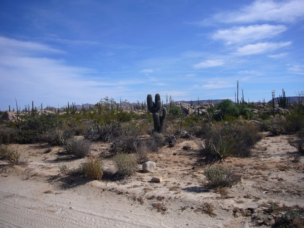
It was a beautiful sunny day and Hwy 1 outside of El Rosario quickly turned into a winding rollercoaster through the desert mountains. It was the kind of road a motorcyclist lives for. Wide open terrain, sweeping turns, and rolling hills. The sky was that perfect shade of blue to complement the brown and arid terrain. Riding through this terrain is a great way to start a day.
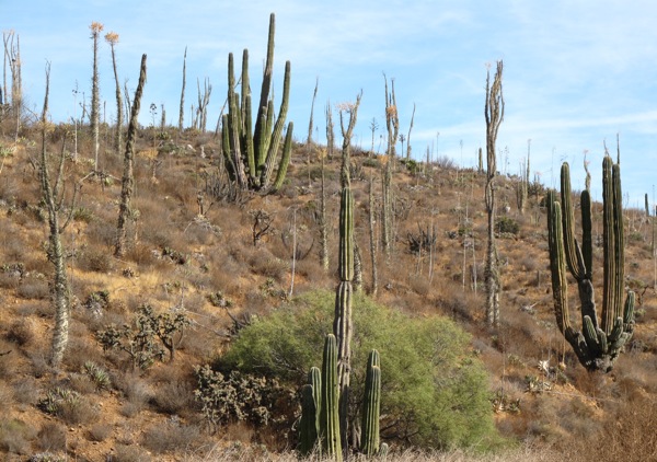
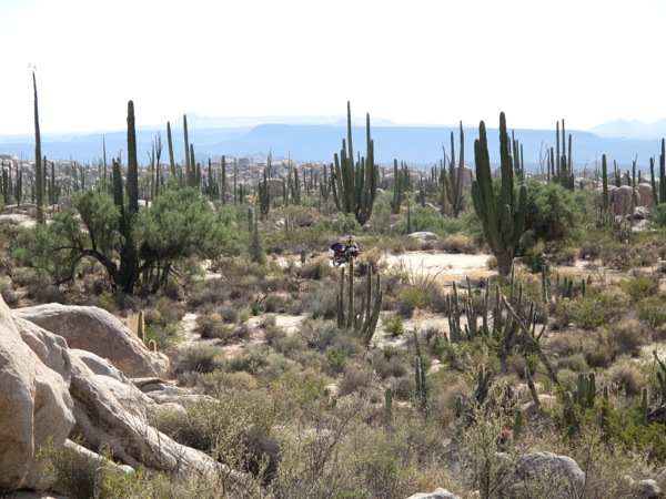
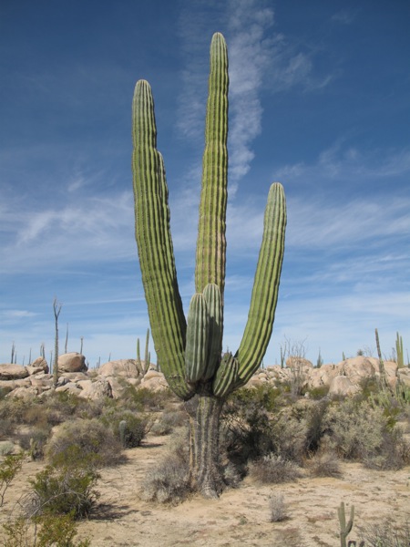
I’ve ridden or driven through many of the deserts of the United States before, but I don’t think I’ve ever seen such a density of cactus before. There were three or four different types: the “classic”, thick branching cactus, tall, skinny xmas tree like cactus, squat and thick with red needles on top, and gnarly twisting branching cactus.
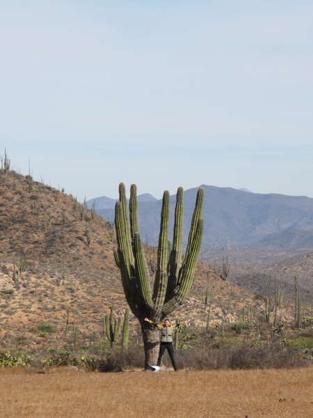
We didn’t make too much progress in the early miles – we kept stopping to take pictures. I think we made 25 miles in the first hour of riding. The landscape seemed to become more beautiful around every corner.
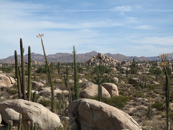
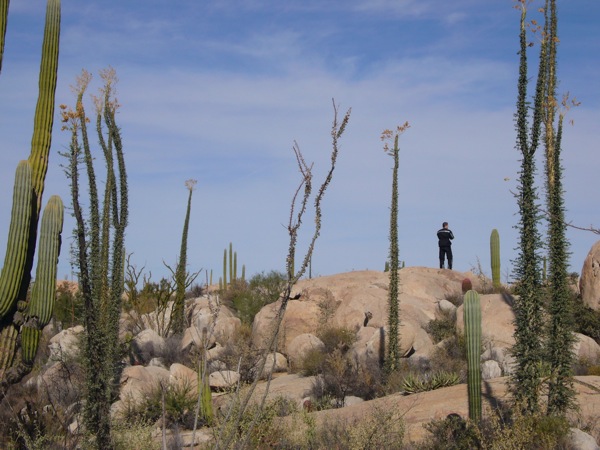
We came to one section of road a little before Cataviña. The landscape was littered with boulders. They were scattered everywhere with some built into large piles. I don’t really understand how something like this forms and would like to learn about the geology of this area. It was stunning to see, ruined only by the insistence of every passerby to write their name in spray paint on the boulders alongside the road.
We decided to take a short detour down a sandy road to immerse ourselves in the boulder field. We probably went 1/4 mile down the road and parked the bikes so we could walk around. I scrambled amongst the boulders, seeking higher ground and snapping pictures. It’s a shame about the timing of this encounter. It would have been a magical place to have a picnic.
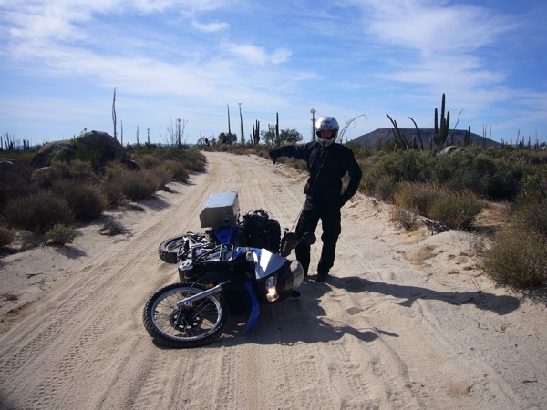
The sandy road was quite the washboard in the wheel tracks. I decided to try my luck riding in the center only to quickly have the front wheel push in the sand. The bike started to tip over and I did a walk off dismount of the bike and it settled on its left side. Luck tried, luck failed. The blue bike is now evenly balanced with a fall on the right and left sides. The bike wasn’t damaged; the soft sand that was the problem in the first place nicely cushioned the bike’s fall. My ego is doubly bruised. I think the crash bars will need a minor adjustment but this kind of thing is what I had in mind when I built the bike up.
We got back on the main road and passed through Cataviña. It was a small town if I use the word town generously. There was one or two restaurants and two hotels. In retrospect we should have just called it a day right there and stayed the night. The desert surrounding it was enchanting, and opportunities to enjoy a landscape like this won’t come often in life.
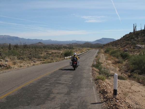
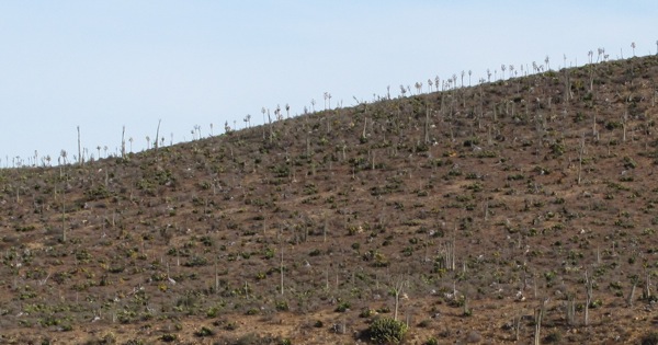
We officially entered the Valle de los Cirios, Valley of the Cactus, shortly thereafter and it was a strange beginning. That particular valley seemed to have less cactus than any of the ones preceding it. It’s a large nature preserve, and after 10 miles the cactus returned in full strength. As we crossed over another set of hills, we entered a rain shadow. The landscape was drier and there were large open spaces of just dirt or sand. We saw a few mirages beckoning us into the landscape.
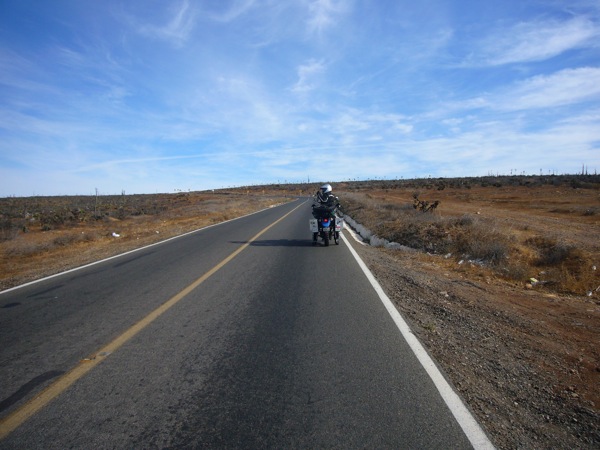
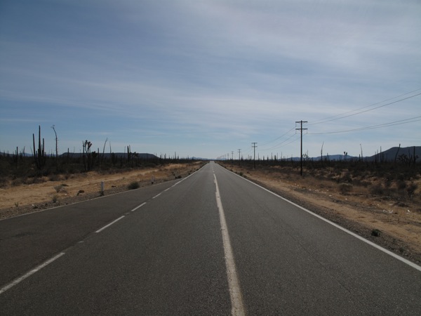
After nearly 100 miles of riding through hills, it flattened out and the road became straighter. It reminded more of West Texas. The riding wasn’t as exciting, but it was still a beautiful day. The temperature fluctuated between 80 and 90, but I was comfortable in my riding gear. Low humidity was a real plus.
After 200 miles, and very close to Guerrero Negro, our goal for the day, we made it to the first gas station since El Rosario. It’s fortunate the KLRs have such big gas tanks as we could have gone another 50 miles or so. We soon went through our first of three military checkpoints of the day, and at the first one they made us stop to show our visas. The other two later in the day just waved us through.
We crossed the 28th parallel, the border between Baja California and Baja California Sur. It’s a good milestone for us. We made it to Guerrero Negro at 2pm, hours ahead of schedule. We rode through town and it wasn’t particularly inviting. Just a few long roads flanked with small shops. It was only a few miles from the ocean and it seemed strange they didn’t put the town near the water. It would have made it far more inviting.
We were early and not excited to spend the rest of the day there, so we made a snap decision and decided to move on to San Ignacio, which was about 60 miles further. There is a naming convention to Mexican towns I don’t understand. This would be the 2nd town where we found two towns close to each other being distinct but having the same or nearly the same name on the map. The guidebook did not make the situation clearer.
We rode east, as this stretch of one went clear from the west coast of Baja to the east. San Ignacio was in the middle. When we finally reached it, it was 3:30 and it was only 60 more miles to Santa Rosalia on the east coast. We made our second snap decision of the day and decided to push through to the east coast, which would give us a nearly open weekend. Our goal for tomorrow had been Mulegé, 60 kms south of Santa Rosalia. Spending in the night in Santa Rosalia would be a short ride on Saturday and we would be taking the day off on Sunday.
The sun was now casting golden light on the landscape, which made the mostly straight road more beautiful. For many miles a volcano called Vulcan Tres Virgines loomed before us. Judging from the peaks it never erupted. Once past, the road descended quickly to the coast. It was the kind of road they would never build in the US and the kind you never catch at the right time. It was a steep but not too steep grade wrapping around the hills until reaching the bottom and the extremely welcome Sea of Cortez.
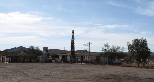
Another few miles down the coast and we were in Santa Rosalia, a busy little town that was founded by the French to mine and smelt copper. We road through town and priced a few hotels before settling on one at the edge of town with good parking for the bikes.
We rode 365 miles today, the longest day Inna and I have ever ridden together. Except for the last 50 miles, the distance flew by and we were surprised at how many miles we had done without it seeming like a grind.
Leave a Reply
You must be logged in to post a comment.