Options:

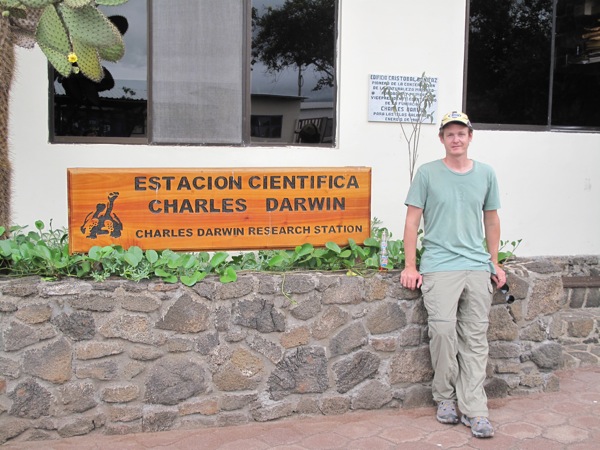
Galapagos Day 4: The Stingray Barrier

Monday, January 26

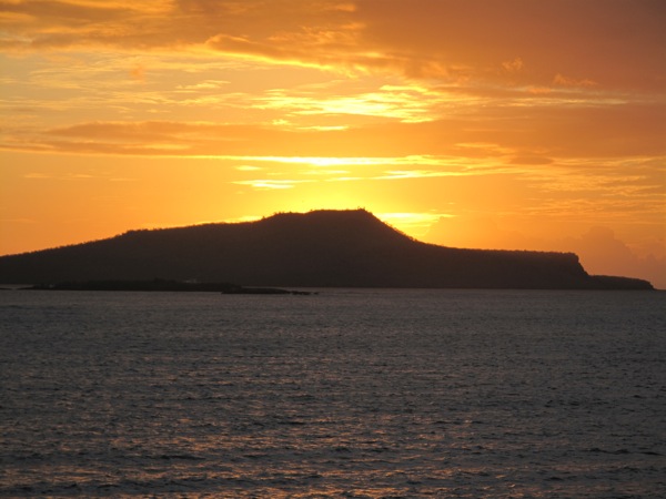
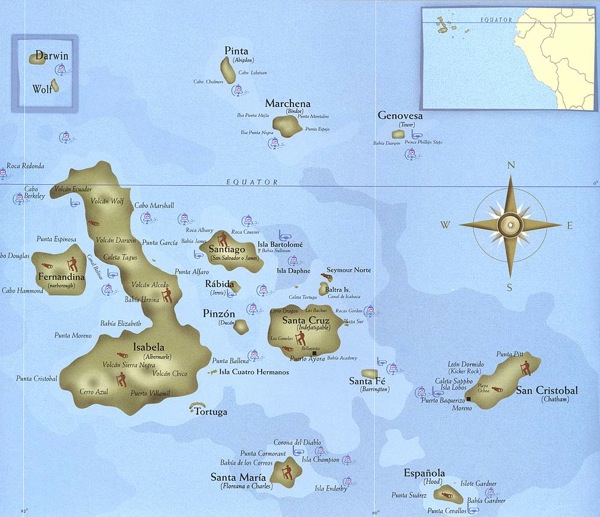
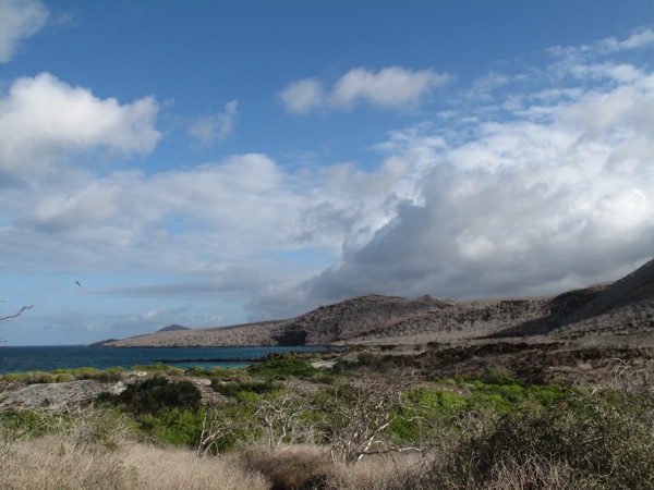
Overnight the boat transited from Española to Floreana. This was an east to west move, so the boat pitched forward and back against the swell as opposed to the previous night’s side to side. For whatever reason I sleep better in that motion.

This morning’s excursion was to Post Office Bay. Since the early days of the Galapagos’ discovery, there has been a barrel on the island used to store mail. Passing ships would check the destination of the stored letters and take any with them that happened to be addressed to a destination near the destination of any of the ship’s passengers. It’s a newer barrel, but the system still works the same. Drop a postcard and pick up any near your hometown or country, and post them when you get home. Sadly it seems much more efficient than it used to be as nearly all of the postcards stored within were from January.

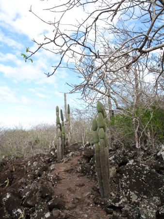
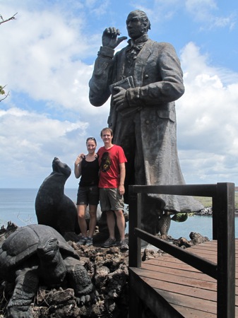
As usual our guide gave the briefest possible explanation and background of the island and the post office. The island had been settled by Norwegians for a few years before they found it too difficult and gave up, the majority returning to Norway. The group ahead of us went further up the hill to look at the remains of the cannery operation and be educated, but our guide decided we didn’t need to know anything else and sent us back to the beach.

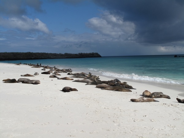
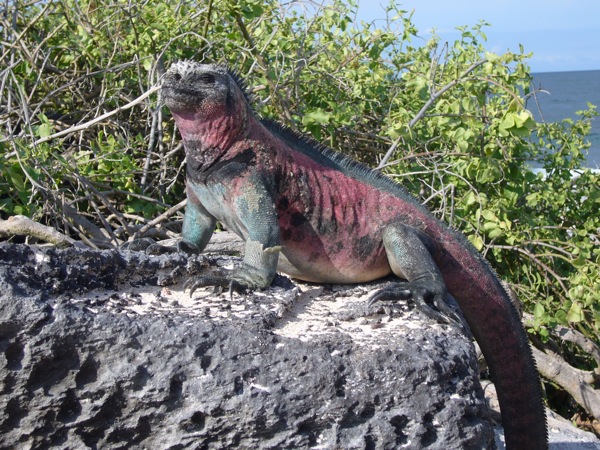
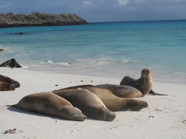
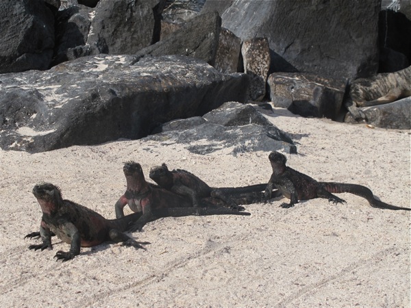
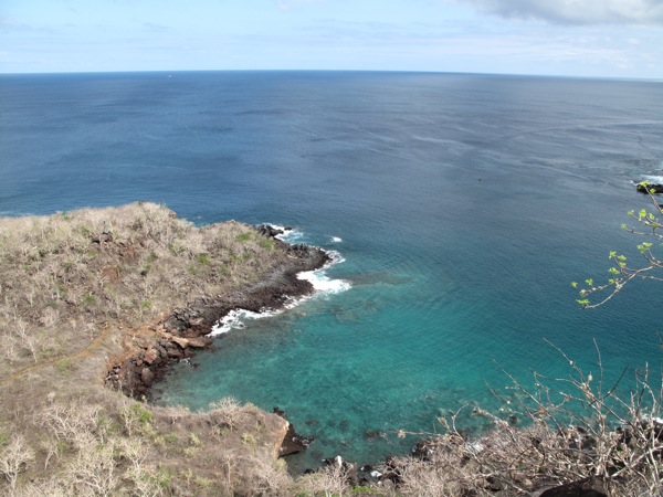
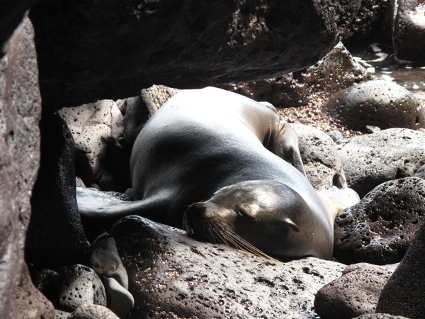
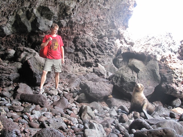
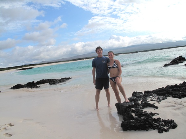
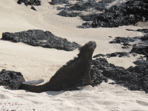
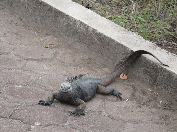
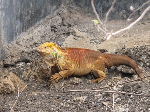
It was another beautiful beach, but unusually lacking in the typical Galapagos fauna. The lack of sea lions left the beach feeling deserted. Even the marine iguanas were few in number. There were many sea turtle nests but no sea turtles. This was the one excursion where I’d forgotten to take the camera in a packing error, and it was the best possible occasion to forget it.

With little to do as we weren’t allowed to leave the beach area, Inna settled in for tanning and I decided to go snorkeling. The water was very shallow for the first 50 meters of the cove and Brian had already gone in. The water seemed very stirred up with sand, so I waited a bit to see if he was finding anything interesting. I noticed he was moving very slowly and was strangely snorkeling on nearly his hands and knees in the shallow water.

When he came back out, he explained that this cove was swarming with stingrays. He said “Hundreds of them, all lying on top of each other”. Stingrays, my favorite. We dithered for a bit, but there was really nothing else to do, so we were determined to go snorkeling on principle. The young couple from Holland also wanted to give it a go. The guide came by and told us the snorkeling is great, you just have to get past the stingray barrier. The stingray barrier.

With four people group psychology kicked in and that phrase became an instant classic. A million jokes were made about Steve Irwin and getting stabbed in the heart and we stood around with the water up to our calves for ages psyching ourselves up and out. When there was a break in the waves, the water would clear and you’d be surprised to see several stingrays cruising only few feet away from you. Then more waves would come in and the water would obscure again, which wasn’t encouraging. It was a hysterical situation and we couldn’t stop laughing at our timidness as stingrays are generally very docile and skittish, but the Steve Irwin incident spooked everyone and we were too busy laughing at ourselves.

F1000016.jpg

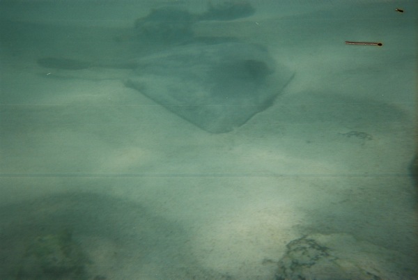
We finally convinced ourselves to get over it and get going. We put the flippers on and slowly, slowly shuffled our feet until the water was over our knees and it was deep enough to float with the snorkel. It was fairly crrepy to see how many stingray were lying on the bottom and we hurried towards deeper water where we could at least float more comfortably. Once we could tread water more jokes were exchanged and we all had a laugh when the Dutch guy was hugely startled by some drifting seaweed.

We were rewarded for our bravery with nothing in particular to see. The visibility of the water was poor, and other than a few piles of huge stingrays, there were only a few fish to see and mostly rocks. We swam farther out and along the cove simply because no one was in a hurry to recross the stingrays and get back to the beach. In the end all of our dawdling worked out perfectly as the dinghy from the boat was heading in to pick people up so we took a lift back to the beach, avoiding all the stingrays. Sweet!

IMG_2555.jpg

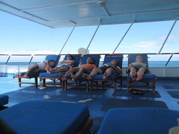
Once back on the boat, we had lunch and lounged around. Everyone was worn out at this point and the upper deck’s lounge chairs were packed with sleeping people. Inna and I read some in our room, did some writing, and tried to take a nap.

F1000018.jpg

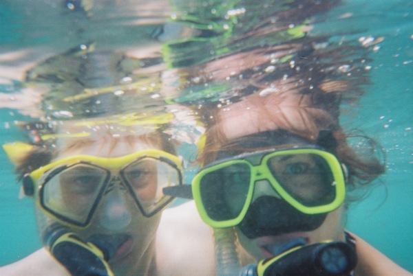
Today we had the unusual addition of a mid day event. Before the afternoon excursion, the stronger swimmers were invited to go snorkeling around an underwater crater called the Devil’s Crown. The current was strong around the rocks, so we would be dropped off in a group from the dinghy, do a quick loop in the current around the outside of the ring, and then snorkel in the more sheltered inside of the ring.

The current was strong and the water a little choppy, but it was great to be in deep open water. The visibility was clear so we could see all the way to the bottom. We saw schools of much bigger fish than those close to shore swim beneath us.

As we came around to near our starting point, we were treated to a few sharks about man size swimming down below. I’d been hoping to see a shark and these were white tipped reef sharks slowly cruising 20 ft below us. I tried to dive down for a better picture but the current was too strong to make any real headway towards them.

F1010008.jpg

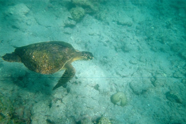
After making it through the strong current of the inlet, we were inside the crown in shallower waters. We took a break in the waist deep waters over a patch of white sand. Inna spotted a sea turtle and everyone chased her and the sea turtle to see it. It was serenely swimming along but hard to catch up with.

F1010004.jpg

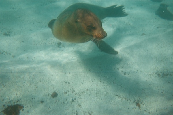
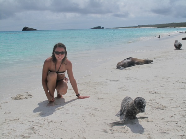
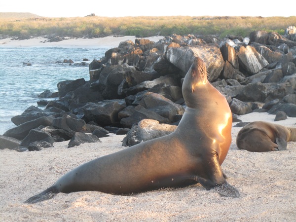
We were snorkeling around enjoying the scenery when two sea lions appeared. They were playing with each other in the shallows and giving us the occasional close drive by. Inna took some great pictures and one of them almost kissed the camera it was so close.

We swam until we were exhausted and then took the dinghy back to the boat.

IMG_2596.jpg
IMG_2681.jpg

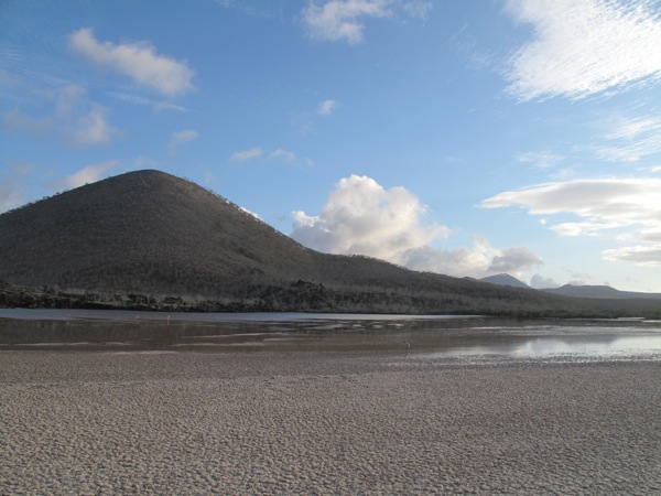
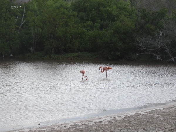
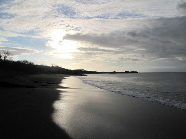
Our afternoon excursion was to Punta Cormorán to see flamingos and sea turtle nesting sites. There was a small, brackish water lagoon inland and today it had a massive population of maybe four adult flamingoes and several juveniles. They fly around from island to island so you never know if you’ll get many, just a few, or none. It was better than none and the lagoon was very scenic in the late afternoon sun.

IMG_2563.jpg
IMG_2631.jpg

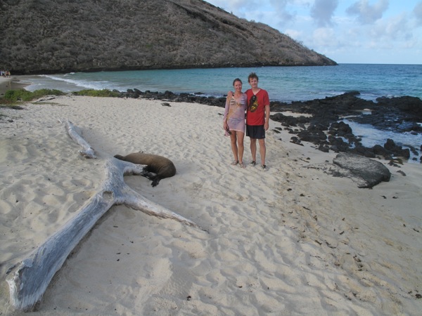
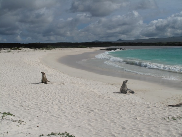
After everyone snapped thousands of pictures of the two nearby adults, we proceeded over the hill towards another beach where sea turtles nested. It was their breeding season so we hoped to actually see some. There were no turtles on the beach, but plenty of turtle tracks. There were just a few sea lions and some marine iguanas. There were about 80 nests along the length of the beach. The guide educated us by chitchatting with another guide.

IMG_2607.jpg

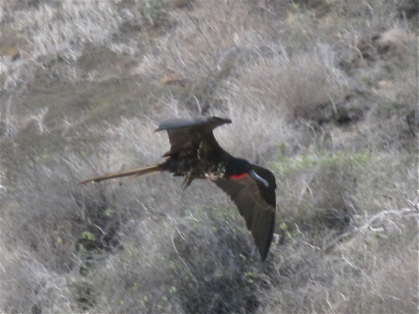
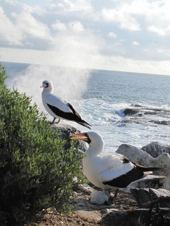
There was a frigate bird patrolling the nests and it was cool to watch. In the strong shore breeze, it just hovered slowly over the nesting sites, moving slowly down the beach, looking for any baby turtles to eat. We could tell it was a male from the red crest on its neck. I managed to get a great video of it hunting.

[qt:/southernexposure/wp-content/uploads/2009/02/mvi_2618.mov 320 240]

As we were about to head back in, we did manage to catch site of a pair of mating sea turtles out in the surf. The male was glued to the back of the female as they bobbed in the surf. It was nice to see some turtles after all the build up and the mild disappointment of so few flamingos.

IMG_2696.jpg
IMG_2706.jpg

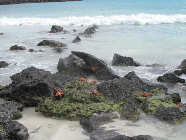
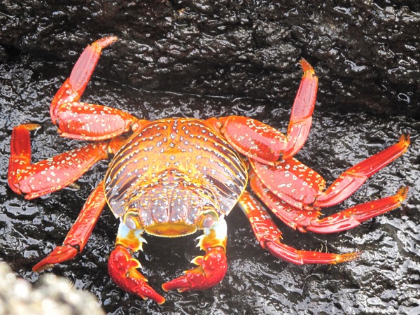
Back at the beach we were too tired to bother with a last shot at snorkeling in the evening light, so naturally the water was crystal clear. Looking at some crabs, I deliberately spooked a bunch to make them move. A big adult used that opportunity to jump down on top of a juvenile and have it for dinner. They told us they eat algae. I got a great picture.

IMG_2698.jpg

Back on the boat everyone was wiped out from the long day, so it was an early bedtime for us.

IMG_2712.jpg

Galapagos Day 3 – Española Island

Sunday, January 25

Our morning landing was at Gardner Bay, which was another stunning beach filled with seal lions,

IMG_2347.jpg

[qt:/southernexposure/wp-content/uploads/2009/02/mvi_2427.mov 320 240]

swimming iguanas,

P1020629.jpg

[qt:/southernexposure/wp-content/uploads/2009/02/mvi_2331.mov 320 240]

and four different kinds of crabs.

IMG_2358.jpg
IMG_2309.jpg

We swam to a rock outcropping 200 ft from the beach to snorkel and saw large schools of fish, eel and sting rays.

IMG_2374.jpg

[qt:/southernexposure/wp-content/uploads/2009/02/mvi_2373.mov 320 240]

After lunch I was trying to take a nap on the upper deck, but kept getting up to watch a pod of dolphins who were chasing our yacht.

[qt:/southernexposure/wp-content/uploads/2009/02/mvi_2389.mov 320 240]

Later in the afternoon we had a dry landing at Punta Suárez. When we got out of the dingy boat the land iguanas and sea lions were blocking the path from the pier.

The iguanas were bunched up together sometimes six at a time to keep warm. It was a fascinating sight.

IMG_2411.jpg
IMG_2405.jpg
IMG_2415.jpg
IMG_2459.jpg

We hiked up along the island trail encountering sea hawks, blue footed boobies, nazca boobies, Galapagos doves, and numerous other birds.

IMG_2472.jpg

The trail opened up to a gorgeous view of black volcanic cliffs dropping swiftly into the ocean, reminding me of Land’s End in Southern England.

IMG_2436.jpg

The high cliffs were known as the Albatross Airport. The strong ocean breeze from the Pacific Ocean to the south provided easy liftoffs for the massive birds. It was the wrong season for albatross, but we were lucky enough to see one lonely albatross. He must have come back early and wondered where everyone else was.

IMG_2496.jpg
IMG_2537.jpg

On the way back we passed a nursery of baby sea lines splashing joyfully in a little lagoon. There was a natural rock barrier separating them from the open water which protected them from sharks. It was impossible to count how many little pups there were as they splashed and wrestled with each other.

[qt:/southernexposure/wp-content/uploads/2009/02/mvi_2527.mov 320 240]

Back on the boat, and after another great dinner we hit the bed at our usual 9 pm. If you’re going to make a trip to the Galapagos, be sure to make it to Española, it was our favorite.

IMG_2541.jpg

Galapagos Day 2 – San Cristobal Island

Saturday, January 24

IMG_2175.jpg

As part of our daily routine, the breakfast was at 7 am. After which we had a dry landing at Puerto Baqurizo Moreno on San Cristobal Island to visit the Interpretative Center. I am not quite sure exactly why it was called that, particularly because our guide interpreted very little, so much so that we were eager to join another group that had a much more engaging guide. It was pretty much a historical and geographical museum that had a number of display boards talking about the human and natural history of the islands.

After the center we had 1.5 hours to spend by ourselves. The guide was trying to sway us to spend it on the town (the guides must be obliged to bring tourists to spend money), but visiting the tourist shops was not at the top of our agenda, so we opted to go snorkeling and hiking with Brian instead.

IMG_2099.jpg

We hiked up to a vista point through a rocky volcanic landscape adorned with occasional cactus and parched trees along the trail.

IMG_2109.jpg

As part of his efforts to dissuade us, the guide had told us it was a 45 minute walk. It took 15 minutes. Looking down we could see a bay which looked perfect for snorkeling and a Darwin sculpture, marking his initial landing in the Galapagos, so we headed down.

IMG_2127.jpg

We found an enclave on the rocky beach that was occupied by a group of sea lions, who were absolutely adorable.

IMG_2153.jpg
[qt:/southernexposure/wp-content/uploads/2009/02/mvi_2141.mov 320 240]

We jumped in the water for our first snorkeling session (snorkeling gear was available free of charge to all yacht passengers). The water was clear and we could see a lot of different fish as well as sea lions who would swing by and disappear into the blue before we could snap a photo with our disposable water camera.

IMG_2164.jpg

We snapped a few more photos and videos of them before leaving the beach, went up to check the Darwin statue, and headed down to the peer to be taken back to the yacht.

IMG_2212.jpg

During lunch the yacht sailed to León Dormido (“sleeping lion”) rocks, that did look like giant sea lions resting on the sea bed.

IMG_2217.jpg

In the afternoon we had a wet landing on Cerro Brujo beach. Although water visibility was poor for snorkeling, the beach was absolutely stunning – the whitest softest sand and turquoise blue water with islands of black volcanic rock scattered along the beach.

IMG_2275.jpg
IMG_2225.jpg

The sea lions and their pups were lounging around the beach.

IMG_2244.jpg

Watching them interact with each other and flap clumsily around the beach made for an entertaining hour.

IMG_2228.jpg
IMG_2240.jpg
IMG_2256.jpg

Back on the boat we opened a bottle of wine that we brought with us, shared a glass with Brian, had another tasty dinner, and as yesterday we were out by 9 pm. At night we were sailing to the next island and both of us woke up a few times throughout the night feeling the boat rocking heavily.

IMG_2291.jpg

Galapagos Day 1 – Santa Cruz Island

Friday, January 23

We woke up early, had a quick breakfast at the hostel and took a cab to the airport for our 12:30 pm flight. We were quite impressed with the free wi-fi at the airport and the service of the local Tame airline. We had a quick stop over at Guayaquil and on a 2.5 hour flight they fed us twice!

IMG_1984.jpg

We landed in Baltra, which is the only airport in the Galapagos located on a tiny island a quick boat away from Santa Cruz, the most populated island. There were five other people who were joining the cruise. A young couple from Holland, a mom and a son from Quito and an Italian fella. A handler guy from the boat met us all at the airport, we took a semi-ferry to Santa Cruz and were split between two cars and taken to a tortoise farm.

IMG_2032.jpg

Our driver/guide was a hilarious if a bit annoying Cuban man (married to a Galapagos native) whose accent and jokes were an absolute imitation of Borat, pretty idiotic and obnoxious.

IMG_2009.jpg
IMG_2021.jpg

The tortoise farm was the first amazing surprise. I’ve only seen land turtles this big once in a Philadelphia Zoo, but these were just roaming around the farm and you could come very close to them, though they would hide their heads as soon as they spot you coming up.

IMG_2019.jpg
IMG_2031.jpg

The farm was on a private property, but the turtles were protected species that occupied that territory. In the 1500’s when the first explorers landed in Galapagos there were thousands of these tortoises around, but they were almost extinct by 1800’s, their meat used for food and shells collected as trophies.

Our next stop was the Charles Darwin Center in Puerto Arroyo.

IMG_2078.jpg

There we watched a short movie about the center’s conservation efforts, saw Lonely George (the only tortoise of it’s kind in existence),

IMG_2056.jpg

the turtle nursery,

IMG_2050.jpg

some striking looking iguanas,

IMG_2042.jpg
IMG_2073.jpg

and headed for the pier to catch a small boat to our yacht.

We were dropped off on our yacht, the San Jose, but nobody was there to greet us. The only people were the other seven passengers – three older Brit couples and their private guide. They had originally charted this boat for an eight-day cruise but half of their group dropped out so the owner of the boat advertised this cruise with tourist agencies to fill it up for the second part of the leg. That’s how we got a last minute deal to join the cruise for half the price.

I had a cup of tea while waiting, and we chatted up with one of the couples. We found out that the guide that was leading this cruise was absolutely worthless, but the food and accommodations were outstanding. Soon thereafter our host/attendant/waitperson showed up and showed us to our rooms.

Later that evening we had a nice dinner in the main dining room, and a meeting with the guide about our plans for the next day. We met a fellow Seattlite names Brian, who had been trekking along Europe and South America for the last year, and was on the yacht from the beginning of the cruise.

We were out cold by 9 pm, looking forward to our wild life adventures tomorrow.

Quito: A Sudden Vacation Decision

Thursday, January 22

We slept in until 9:30 am, and by the time we rolled out of our room in hopes of having breakfast at the hostel, they could only serve us coffee and one glass of juice. We weren’t particularly impressed with our hostel and it was not available to us the next day, so our plan was to find another place to stay in the neighborhood, visit the Kawasaki dealership to make the last attempt of checking on the problem with my oil leakage, in addition to changing the oil on both bikes and putting a new tire on Matt’s bike. We were also going to a Mac store to try to figure out what was wrong with our laptop.

We checked out a couple of hotels in the area and made a reservation in one of them for the following night. There were a great number of travel agencies in the neighborhood advertising trips to the Galapagos Islands. Although we have dropped the idea of going there because of the cost and the time it would entail, we decided to pop into one of the agencies and find out what kind of packages were available out of curiosity. The pictures that hung on the walls of the Galapagos sea lions, tortoises, and lava lizards as well as sunsets and the white sandy beaches were quite amazing. Knowing that this was probably our best opportunity to ever visit the Galapagos, we made a split second decision to go to the islands if we could find a suitable tour.

Galapagos_Map.jpg

There were two options available, both for a five day/four night adventure that started the next day. The first option would have us staying at an all-inclusive hotel with day trips to volcanoes, beaches, wild-life watching, snorkeling, horseback riding, and other activities on two different islands. The second option was a yacht cruise that would visit four different islands with similar activities, but a better variety of site visits, and for a higher price of course. We visited four different travel agencies in order to compare prices and offers, and settled on one agency that seemed to be the most professional.

The lady manager offered to store our bikes in her garage for the duration of the trip if we were to book with them. That was a huge plus for us. We were given two hours to decide because the flights left in less than 24 hours. We went back to the hostel and tried calling Matt’s dad who had been to Galapagos before in order to find out which option was better for us. They both sounded wonderful, the first one seemed to be more active and adventurous, while the second more unique and luxurious and covered more sites. Matt’s dad wasn’t available, but Matt’s mom voted for a yacht, saying that a bit of luxury might be a nice break for us. Deep down I think we both were leaning towards the yacht.

The time has come for us to walk back to the agency to book the trip. Because we were flying out of Quito tomorrow and booking at the last minute we had to pay cash for the yacht part of the trip, which was a very hefty sum of money. Too bad I didn’t take a picture of me with all the cash I was carrying, which was more than our bikes’ air freight cost. But this was a once-in-a-lifetime opportunity and we could not miss our chance to visit the Galapagos when we were so close. We handed off the money and our passport info to the travel agent and agreed to be back at the agency by 7 pm to pick up our tickets and to follow her to her house to drop off the bikes there.

Our next stop was the Mac store. We told the service guy that we could not connect to the Internet anywhere, and of course when he tried connecting to the network it worked perfectly. We asked him where we could buy a USB wi-fi adapter and he directed us to a store about 10 minute cab ride away. It turned out to be a Mac service store which is not what we needed, but there we got the name of the computer store where we could find the adapter.

We were off to the Kawasaki dealership to book an appointment for next week after we are back from Galapagos. The dealership – Kawamoto – was a good size retail and service shop. They had about eight KLRs on sale (price tag with taxes $10,750 vs $5,500 in US), which was a good sign for us. We talked to the service manager who looked like a mad scientist in his Kawasaki shop coat and were scheduled to bring in the bikes next Wednesday morning.

We continued our search for a USB wi-fi adapter, but unfortunately the biggest computer retailer in the city carried only PC compatible adaptors.

Back at the hotel, we quickly shuffled our clothes and things between the bike boxes and our carry ons for the islands and drove to the travel agency to meet with the agent. She handed us our papers and tickets, and we followed her to her house. Parked the bikes in her garage, left our gear in her house and she dropped us off at a Tandori restaurant for dinner. The place was written up in the book as the best Indian in the city, but it was probably the worst Indian food we ever had – completely flavorless and tasteless. Or well, hopefully the food on the boat will be better. We went to bed early anticipating a long traveling day tomorrow.

Tulcan to Quito: 9,350 ft Above Sea Level

Wednesday, January 21

IMG_1940.jpg

We woke up early, had a quick grocery store breakfast of oatmeal cookies and yogurt and were on our way to Quito.

IMG_1944.jpg

We continued riding through the Andes, surrounded by mountains on both sides, though not as spectacular as in prior days, the scenery was still very pleasant and we stopped frequently to take pictures.

IMG_1946.jpg

We were riding through a countryside and were amazed at how far up the steep slopes people were farming.

IMG_1947.jpg

Since we didn’t have to cover too much ground that day, we stopped for lunch at Otavalo. This town about 30 minutes away from Quito has one of the largest crafts markets in Ecuador on the weekends. Unfortunately, it was a weekday, and the town felt pretty sleepy. The restaurant we chose from the book was in the Ali Shungu hotel, owned by a charming American born woman Margaret, who was very welcoming, impressed and enthusiastic about our journey. The food was all organic sand absolutely delicious. I had a tomato soup and avocados stuffed with tuna salad and Matt had a grand veggie sandwich. It was the best lunch since I can remember.

P1020624.jpg

On the way out of town we passed the market square, and although it seemed like we could probably get some cool things at the weekday market, we didn’t feel like stopping, finding parking, securing our gear, etc, so we kept on going to our next destination – the equator.

IMG_1975.jpg
IMG_1954.jpg

There are two equator markings in Ecuador – the proper one at 0 latitude, which is the one we were going to visit, and a touristy monument outside Quito, Mitad del Mundo, that you see in all the pictures, which is actually off by a number of degrees.

IMG_1967.jpg

We pulled up to the site and were the only people there. There was a young kid who told us we could ride our bikes right into the round plaza that had a pole and an equator division line in the middle of it. The whole thing was a sun dial, so when it’s sunny you could actually tell the time. It was cloudy, so we couldn’t. The kid turned out to be a guide from a non-profit organization that performs equator research, he had a number of story boards, photographs and maps set up, and explained to us how to use the sun dial. This area had been marked as the equator by the Inca and their predecessors, with monuments built marking the equator and the two equinoxes. This is the highest spot on the equator in the world which makes it a great place for stargazing as both the constellations of the northern and southern hemisphere are visible. It was a nice educational impromptu lecture, so we bought a dvd and a couple of maps from him with proceeds going to the non-profit. We tried giving him a tip, but he refused it. Imagine that!

IMG_1972.jpg
IMG_1977.jpg

We took all the necessary photos, thanked him for his time and got going. After about 15 minutes we were pulling up to Quito. The city is huge, spread out lengthwise within a narrow valley – 4 km wide and 30 km long. We were anticipating a traffic nightmare trying to find our hostel in an unfamiliar city, and it did turn our quite maddening and tiresome, especially since all the maps and directions we had were worthless. It took about an hour and a half to first locate ourselves in the right part of town, then in the right neighborhood, then match a street to any of the streets on the map, find the right street and the right corner, ride around the block a few times until we finally noticed our disguised hostel.

P1020626.jpg

By the time we unloaded the bikes and settled in, it was time to find some dinner. We stayed in the newer part of town called La Mariscal, which had a lot of restaurants to choose from. We originally chose an Indian place from the book to go to, but could not find it, so ended up in an Ecuadorian restaurant where I had a very delicious local soup called locro, made with potatoes and avocado.

When we were unpacking Matt noticed that he left his watch at the hotel in Tulcan. He was very upset as he really loved that watch. It was our alarm clock and it was left wrapped around the headboard in the hotel.

We also noticed that for the third day in a row our laptop was not picking up the wi-fi signal where wi-fi was available. We tried a few coffee shops and internet cafes in addition to our hostel and had the same problem everywhere. A possibility of our wi-fi connection being broken worried us a lot, so the day ended up on a sour note.

Pasto, Colombia to Tulcan, Ecuador: Inauguration Day and Border Hassle

Tuesday, January 20

We woke up around 9 am, had breakfast at the hotel and came back to the room to watch Barak Obama’s inauguration ceremony. We have been waiting for this moment ever since we left Seattle, hoping we could be somewhere in a bar with a bunch of Americans getting drunk on beer in the middle of the afternoon. Instead, it was just two of us high up in the mountains of Colombia’s border town in the Junior Suite room of a nice hotel watching the the ceremony on a flat screen TV. I guess it could have been much worse than that.

We were savoring the moment as we watched Obama’s acceptance speech. It has been a long road for him and because we have supported his campaign every step of the way (Matt was even a district delegate), it was a celebratory and gratifying moment for us as well.

P1020621.jpg

As soon as the speech was over, we packed our bikes and were on our way to crossing the border into Ecuador. We only had about 80 km to ride to the border and once we got out of the foggy town it turned out to be a nice and sunny day.

IMG_1930.jpg

We planned on stopping in the town of Las Lajas to see a spectacular church there before crossing the border. Unfortunately, we spent our last penny on gas and could not even afford parking the bikes in the special parking lot that was mandatory for going into the church. I agreed to guard the bikes while Matt went to the church, but the walk was too long to do in riding gear, so we abolished the idea and took pictures of the church from the road instead.

IMG_1931_2.jpg

We arrived to the border around 2:30 pm. When we got to the aduana on the Colombia border, the lady took our import papers and told Matt we didn’t need to do anything else on this side. We crossed into Ecuador and joined a long line of people for passport control. The line was not moving for two hours.

IMG_1937.jpg

Finally, we got into the building and the moment we gave our passports to the immigration officer the computers went down, which I guess is what happened while were were standing in line earlier. Half an hour later, the computers were back on, but it turned out we needed to get stamped out of Colombia. Not sure how we got misled by the lady on the Colombia border, by now we should know the procedure by heart. So we drove back to the Colombian side, got the passports stamped and I was back with the immigration officer, while Matt went to start the bike importation process. By 6:30 pm we were finally done, but our plan of riding 100 km to the next big town in Ecuador was not going to happen because it was getting dark very fast.

We decided to spend the night at the border town of Tulcan, which was only about 10 km ride inland. We took the first cheap hotel we found because it had secure parking, and hot water. The hot water however was not working as we found out later. After a quick dinner we went to sleep. Tomorrow we will be arriving in Quito.

Solento to Pasto: Welcome to the Andes

Monday, January 19

IMG_1871.jpg

We slept well and woke up early. We ate a Mexico style convenient store breakfast of coffee, some yogurt, and a granola bar. Since it was still raining, we weren’t very enthusiastic about touring the Cafe Zone, as beautiful as it was. We were aiming for a long day of riding with hopes of reaching Pasto. We wanted to spent the night in a big city so we could watch Obama’s inauguration on an international (English speaking) news channel.

IMG_1870.jpg

We rode back across the valley towards the main highway. Low clouds or steam was rising out of the forests, giving the morning a primeval feel. We kept stopping to take pictures because the valley was so sublime. It’s not hard to see why the Cafe Zone is considered so special and under different circumstances I would like to spend more time touring the region.

IMG_1875.jpg

After numerous photo ops, we were back on the road south to Armenia. We managed to resist the smells of roasting coffee and get through the town without stopping. The highway gently descended out of the green hills into more conventional farm country. The traffic was light and the road wasn’t particularly twisty, so we made great progress for 100 miles.

IMG_1883.jpg
IMG_1884.jpg

We had had such a light breakfast, we were planning on an early lunch. Around 11 we started keeping our eye out for a nice place to stop, but when you’re hungry you tend to find yourself in open countryside. We passed a few papaya plantations which looked tempting. We pulled off to enter a small town, but after riding through the main plaza, the town seemed particularly uninviting, so we passed and moved on. Near noon we came to Santander de Quilichao, where we pulled in. We asked for the menu at the restaurant we had chosen, and were told there was no menu. It was chicken or chicken. We’d chosen a rotisserie chicken restaurant, which was fairly obvious if you looked over at the huge spinning roaster busily cooking up 50 chickens at a time. You only picked if you wanted 1/4, 1/2, or a whole chicken. We each chose a quarter, which came with fries, rice, and a salad. It was particularly delicious. Specialization has its dividends.

P1020607.jpg

We continued our way south and the road began to climb again. We passed Popayán at 6,000 ft and as was now typical with the scenery at this altitude in Colombia, it was beautiful. I’m repeating myself describing how lush and verdant the hills and mountains of Colombia are – the pictures will have to tell the story.

IMG_1890.jpg
IMG_1894.jpg

After enjoying the scenery along this high plateau, we began to descend again. The road was very narrow and twisty. It was a nice change from the less curvy stretch prior, but we had to be cautious. The road was still wet from rains, and it was clear the rainy season had taken its toll on the road. We passed numerous slide zones where the road was closed to one lane. In other places the road had sunk 6 inches with a token patch of asphalt to ramp up and ramp down. You’d be cruising along and then the road would temporarily drop 6 – 12 inches for 50 ft before you hit the ramp back up.

P1020611.jpg

Once we had descended into the valley, the road improved. We had passed many military checkpoints, but our luck finally ran out and we were stopped and my bike was searched. Fortunately it was only a pannier search, no tedious unloading of the duffle bag. You can tell it’s a half hearted search when they don’t open the duffle bag. I gave my standard spiel to the officer, and he checked our papers. I asked him about the road damage, and he said the hills are always sliding, so they do what they can but it will never be perfect. He asked us for our insurance, but we didn’t have any for Colombia. No one had said it was mandatory. I told him that and he seemed satisfied, said things were “muy amable” and let us go on our way.

IMG_1900.jpg
IMG_1905.jpg

We couldn’t have been going for more than a half an hour before we were stopped again. As we came into view, a group of very young male soldiers formed a line across the road to stop us. The only reason they stopped us was that they were bored, and we are an exotic stop. I chatted with them for a bit as they surrounded the bike, which freed Inna up to take some pictures. After about 10 minutes of chatter, we were cleared to go and were off. They said we had a long way to go to Pasto.

P1020614.jpg

Once we crossed a big river, we began to climb again. The mountains across the river were quite spectacular. Like one of the chains of mountains we encountered in Mexico, the clouds were spilling across the peaks like a fog. The mountains looked to be losing their battle to hold back the clouds.

IMG_1915.jpg

The twists and turns of the climb out of the valley were more open and sweeping than the descent, so it was less work and more fun. We reached what I’d call the plateau of highland Colombia. It’s between 5 and 6,000 ft high, and green, green grass without too many tall plants or trees.

IMG_1924.jpg

The mountains here are just incredible. The road clings to the side of the mountain, which form a smooth plane with a distinctly vertical camber. If the base level is 5,000 ft, the valleys between the mountains seem to descend all the way to sea level, where a rapid, chocolate river continues to cut the valley. We’ve never seen anything like this before and it was enchanting. Above the road the peaks tower over you, and the road just goes up and up as it winds around the peaks.

IMG_1925.jpg

In the back of my mind as we ascended was that somewhere up here, ahead of us, was the large city of Pasto. It was hard to reconcile with the green peaks surrounding us that on some higher yet plateau thousands and thousands of people had built a modern city. As we neared Pasto, the light was fading, and as such things go, we had reached the level of the clouds. It was dark and we were riding in a damp, thick cloud. We were only 10 km from the city, so we made the easy choice to just latch onto a slow going car and follow its taillights into town.

IMG_1928.jpg

The highest point of the ride was 9,300 ft, and we descended down to 8,400 feet in downtown Pasto. We stopped at the first nice hotel we came to, and since it clearly had secure parking, I asked the concierge if their TV lineup had an english speaking news channel. We had ridden this hard to be sure we had a nice place to watch the inauguration the next morning. He wasn’t sure, so he took me up to what would be our room, and we channel surfed. I was really hoping for BBC World News, and resigned to CNN International. To my immense irritation, the only option was Fox News. Weak! It would do and it had its own irony. We settled in quickly, exhausted from a 370 mile ride through the mountains. It was one of the best days of riding of the entire journey.

Bogota to Solento: Riding the Colombian Mountains

Sunday, January 18

Despite the party the night before, we managed to get up early and be ready to head out by 8:30. We felt bad about waking up Lew and Jennifer to say goodbye, as they’d been up quite late, but it would have been rude to miss a proper farewell. We thanked them as profusely as we could for their generosity and hospitality and departed. It’s a shame we didn’t get to say goodbye to Jeffrey but he was still asleep.

Our last stop before leaving the city was breakfast at Oma with Raffael. We had a nice breakfast as I handled translation between Raffael and Inna. We were definitely going to miss the great food of Bogotá. Raffael further demonstrated his generosity by bringing us better maps. One was a map of the Cafe Zone region, which he was insistent upon us visiting, saying we couldn’t leave Colombia without seeing it. The other was a detailed route map between Armenia and Ipiales at the Ecuadorian border. We had planned on buying Raffael breakfast to attempt to repay some of his generosity, but he intercepted on the waiter before we even realized what was happening and paid the bill. So frustrating!

IMG_1822.jpg

After a group photo, we were back on the bikes. Raffael was going to lead us to the freeway we needed to take towards Armenia. Our goal for the day was to reach Cali via Armenia. Raffael made one quick stop as we were heading out, and came back with Colombian flag stickers for our bikes and pins for our chalecos. The guy just didn’t let up on the generosity. He led us across town and we reached our farewell. It was a sad farewell.

Bogotá had been an amazing demonstration to us of kindness and hospitality. Lew and Jennifer took us into their homes and treated us like family on only the virtue of being a son of a former colleague. They transformed what could have been a very stressful few days into a relaxing and festive Bogotá adventure. We are in their debt and hopefully someday can return the favor. Raffael was literally a stranger we met on the street, and he treated me like a brother, worked on Inna’s bike, and escorted us to our exit. As much as the beautiful landscapes, it’s the people we meet who are shaping our memories of this journey. It’s hard not to think of Bogotá warmly.

IMG_1826.jpg

We rode out of Bogotá south on a secondary road. The road was a gradual descent from Bogotá’s 8,700 ft through the abundantly green Colombian landscape. We knew we would be crossing La Linea, a pass that crests at over 10,000 ft, so we had taken the opposite strategy today than we had when we froze in Costa Rica, and were dressed in warmly in our waterproof layers.

IMG_1829.jpg

We had come down several thousand feet, and the twisty road yielded miles slowly. Now that we were at lower elevation, the heat and humidity made their presence known. We were both dying in our waterproof layers, but we didn’t want to take the time to stop and strip them off only to have to put them back on later. Our map was terrible, with no altitude markings, so we only roughly knew where we would begin to ascend again.

IMG_1831.jpg

The scenery was less spectacular at this altitude and we skipped lunch to keep moving. At one point I was hoping it would actually rain to cool us off. Once we had connected with the main highway, we were moving faster. After going through a few small towns and a few river crossings, we finally began to climb towards cooler temperatures.

P1020596.jpg

The beauty of Colombia increases with altitude. The vegetation just radiates high intensity green, making even the hills of Costa Rica seem washed out in comparison. We marveled at vista after vista as we enjoy the twisty climb into the mountains.

IMG_1836.jpg

We were making better time than before and were fortunate to be traveling on a Sunday. We passed hundreds of big trucks parked in truck stops as they are required to stay off the roads on Sundays. The only obstacles to progress were the buses. The toll plazas helped space out the traffic and gave us opportunity to take pictures without being repassed. The Colombian government is kind enough to not assess tolls on motorcycles, so we slipped through an almost too narrow right lane without having to pay the tolls.

IMG_1851.jpg

We finally reached La Linea, and as we stopped to take pictures of the hillsides, a couple on a small bike stopped to chat with us. They were curious about our bikes and I gave them my standard spiel about what we’re up to. We ended up riding with them throughout the descent. While I chatted in Spanish, Inna took pictures. It’s hard to emphasize enough how beautiful Colombia is and how far it exceeded our expectations.

IMG_1848.jpg

As we crossed over 10,000 feet, we found ourselves within a cloud, being rained on. The suffering in the heat was rewarded. Visibility was poor, and it was no fun riding twisty roads in the rain. Our descent was cautious and slow as we waited to get below the cloud level. We finally broke through but the rain stayed with us. The ride down continued the breathtaking scenery, but we were focused mainly on the road at that point.

IMG_1844.jpg

We finally reached Armenia at around 4 in the afternoon and accepted that we had been grossly off in our belief that we could reach Cali in one day. We had gotten used to being able to ride across half the map in a day in Central America, and we’d barely covered a few inches of the Colombia map. It was just as well, as we could spend some time in the Cafe Zone. On Raffael’s recommendation, we proceeded north to the small town of Solento. The secondary road from the highway to Solento was a series of mountain curves carved out of bright green hillsides. This is the region of Colombia famous for coffee and we would occasionally ride past a house or restaurant and the air would be rich with the scent of roasting.

IMG_1860.jpg

Solento itself was a picturesque village perched on hilltop overlooking a long valley. The rivers were flowing a deep brown torrent from all the rain. We were directed to a small hotel with secure parking all for less than $20 a night. We walked into the main plaza, which was still bustling with stalls from the Sunday markets and festivities.

IMG_1863.jpg

Inna chose our dinner restaurant where she was treated to some excellent local trout. It had been an exhausting day of riding so we were asleep soon after. It rained heavily overnight, enough to make me wake up and peer out the window to see the downpour.

Bogota: The Salt Cathedral

Saturday, January 17

We woke up around 10 am, feeling a bit beat up from last night’s fun at Andre’s. After breakfast we decided to visit the Salt Cathedral, a tourist destination that Lew recommended, about 30 km outside of Bogota. Jeffrey had a day off from school and was hanging around out at home playing video games while Lew and Jennifer went to a wedding.

The ride to the Cathedral was along the same road as Andre’s restaurant. Lew warned us yesterday that there was a man hole cover on the road that was actually not covered, just a 2 ft hole on the main city road – extremely dangerous for motorcyclists. He pointed it out to us last night, saying that it has been there for at least two months and nobody was in a big hurry to cover it up. Riding that three-lane road I was nervous about ending up in the wrong lane at the wrong time. It also started to rain, which always makes me ride half the usual speed, and I think I was getting on the nerves of the crazy Bogota drivers being so cautious. Once we passed the man hole we knew about from Lew there would actually be at least two more during our trip to the Cathedral and back that we had safely avoided. I simply don’t understand how such major road hazard especially in the city filled with motorcyclists can stay unattended for 2 months.

IMG_1818.jpg

After a wet ride we got to the small town of Zipaquirá that housed the salt mine and the subsequent Cathedral. We got our tickets and waited in line to get into the mine. The group we started with had about 25 people and the tour was in Spanish. We asked if there were any tours in English and were told to wait another 20 minutes. We only waited for about 10 minutes when an English speaking guide showed up and we had our own private tour.

IMG_1817.jpg

This mine is the largest salt mine in South America and produces about 85% of all salt in Colombia. The first Cathedral in that mine was actually built by the miners for religious purposes in the last century and was located about 2,700 m underground. It became dangerous for visitors as the salt rock is very unstable, so it was closed and a new site was built 300 ft below ground in 1990 mainly as a tourist attraction, but nevertheless impressive and very surreal as everything there was made out of salt rock.

IMG_1810.jpg

There were about seven or eight chambers each served as a station of the cross, culminating in a major hall with the largest underground cross in the world carved out of the salt rock.

catedral_de_sal.jpg

The guide told us that there were only about three baptisms and four weddings performed in the Cathedral which seemed like too few considering how gorgeous and unusual the place was.

IMG_1808.jpg

There was a room filled with salt carved figures depicting a nativity scene, a round dome room lit up in neon blue light, a “three spirits” room and a few other rooms all lit up with neon blue, purple, green, red or white light adding to the surrealist quality of the experience.

IMG_1804.jpg

After the main ceremonial hall with the cross we entered a room for honoring the dead. I felt a strong desire to spend a few minute there to honor my mom. Our tour was over so I asked Matt if we could sit on one of the benches in silence. I closed my eyes and started getting immersed in the inner feeling of warmth and calmness, evoking my mom’s spirit. A very soft sound of monks chanting started coming out of the walls. Strangely, I haven’t noticed the music before, but now, as I was tuning inward, it was providing a perfect background to my meditation, especially meaningful because mom used to love to listen to her monks chanting tapes. A few minutes later a large group of tourists came in and it was difficult to concentrate, so we started our walk back out of the cathedral/mine, feeling very peaceful, happy and content.

We rode back to Bogota in the rain, and when we got to the apartment Jeffrey was still home playing video games. We decided to take him out as it seemed like he could use some company. We had a tasty lunch at an Asian place called Wok – we have never been so excited to eat spring rolls, phad thai, and curry. We finished off our lunch with a cup of coffee and dessert from Oma and headed home to take a rest before the home party that night.

P1020591.jpg

I was feeling quite exhausted by 8 pm, but it was time to get ready to socialize. One of Jennifer’s friends Dani came specifically to talk to us after he found out about our journey. He had also ridden his bike to Ushuaia a year or so ago from Colombia and wanted to share his thoughts and suggestions with us. He was one of the first to arrive and we spent an hour looking at maps and making notes of his route. We met other interesting people, friends and family of Lew and Jennifer, and everyone was quite impressed with what we were doing. At midnight I could not hold it any longer and went to bed. Matt showed up soon thereafter. The next day we were departing Bogota to go south.